Cyclones in the Sundarbans and Environmental Challenges:
Living on the Edge of Land and Sea
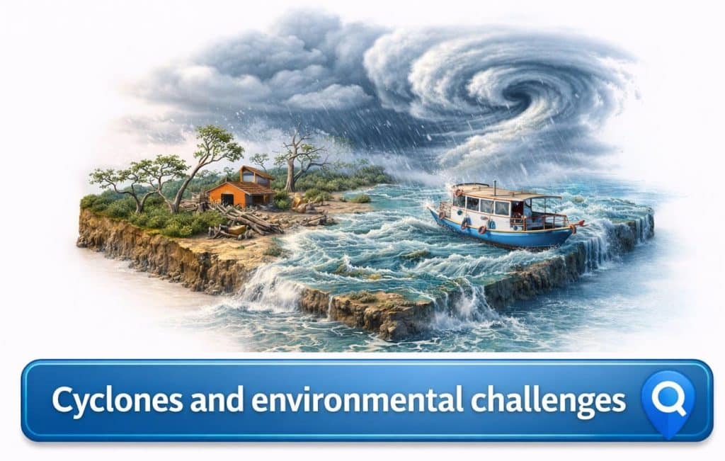
Cyclones in the Sundarbans are not rare interruptions; they are recurring forces that reshape the delta’s geography, ecology, and human settlements with relentless intensity. To travel through this vast mangrove labyrinth is to understand that beauty and vulnerability coexist here. The Sundarbans, positioned at the northern edge of the Bay of Bengal, stands directly in the pathway of tropical cyclonic systems that gather strength over warm waters before striking the coast. These storms do more than uproot trees or flood villages—they alter salinity, erode embankments, redistribute sediment, and challenge the delicate balance between forest and habitation.
For those planning a Sundarban Tour, understanding cyclones and the environmental challenges they intensify is not merely academic knowledge. It is context. It explains why embankments are reinforced with urgency, why mangrove replantation is ongoing, and why local communities maintain a deep respect for weather signals. The Sundarbans is not a static wildlife reserve—it is a frontline landscape negotiating climate change, sea-level rise, and increasingly powerful storms.
Why the Sundarbans Are So Cyclone-Prone
The Bay of Bengal is one of the most active basins in the world for tropical cyclones. Warm sea surface temperatures, combined with atmospheric instability and seasonal wind patterns, create conditions conducive to storm formation. When these systems intensify and move northward, the funnel-shaped coastline amplifies storm surge impact. The Sundarbans, being low-lying and interwoven with tidal channels, becomes especially vulnerable.
Unlike rocky coastlines that can deflect or absorb wave energy, the Sundarbans consists of soft sediment islands. Many inhabited areas stand only a few meters above sea level. Storm surges push saline water deep into agricultural land, freshwater ponds, and forest interiors. Cyclones here are therefore not just wind events; they are hydrological invasions that can transform soil chemistry for years.
Storm Surge and Salinity: The Invisible Aftermath
When seawater crosses embankments
The most devastating aspect of cyclones in the Sundarbans is often the surge rather than the wind. Embankments built to protect villages can breach under pressure, allowing seawater to flood croplands and freshwater reservoirs. Once saline water settles into soil, it alters agricultural viability. Paddy fields can remain unproductive for multiple seasons, forcing communities to shift livelihoods.
Mangroves as natural buffers
Mangrove forests play a critical role in reducing storm impact. Their complex root systems dissipate wave energy and trap sediment. Areas with denser mangrove cover frequently experience less erosion compared to exposed banks. However, repeated cyclones weaken even these natural defenses. When root systems are uprooted or sediment layers shift dramatically, recovery can take years.
Travelers who engage with reliable planning resources such as Sundarban Travel often learn that conservation here is not abstract—it is practical survival. Replanting mangroves is not symbolic environmentalism; it is structural protection for both wildlife and villages.
Major Cyclones and Their Ecological Impact
In recent decades, cyclones such as Aila, Amphan, and Yaas have left profound marks on the delta. Large tracts of forest were damaged, embankments collapsed, and freshwater sources turned saline. The ecological consequences extended beyond immediate destruction. Increased salinity influenced fish breeding cycles, crab populations, and vegetation composition.
After severe storms, certain mangrove species show higher mortality rates, particularly those less tolerant of extreme salinity. Wildlife patterns shift as prey distribution changes. Even bird migration patterns can reflect altered habitat conditions. The forest does regenerate—but regeneration is a slow negotiation between soil chemistry, tidal movement, and seed dispersal.
Climate Change and Intensifying Cyclones
Rising sea levels
Sea-level rise compounds the cyclone problem. Higher baseline sea levels mean that storm surges penetrate further inland. Islands that were once marginally secure now face greater erosion risk. The gradual loss of land is visible in shrinking shorelines and submerged tree trunks at the edge of channels.
Warmer waters, stronger storms
Scientific observations indicate that warmer ocean temperatures can fuel stronger cyclonic systems. The Bay of Bengal has shown warming trends, increasing the likelihood of high-intensity storms. For the Sundarbans, this means that what was once considered an extreme event may become more frequent.
The cumulative effect is not only environmental stress but also human displacement. Migration patterns from vulnerable islands to mainland districts reflect a silent adaptation to climatic uncertainty.
Human Settlements and Livelihood Challenges
Life in the Sundarbans has always required resilience. Fishing, honey collection, crab farming, and small-scale agriculture are tightly linked to environmental stability. Cyclones disrupt these systems simultaneously. Boats are damaged, nets lost, fields flooded, and freshwater ponds contaminated.
After storms, communities often rebuild embankments collectively. This collaborative effort highlights the interdependence between people and landscape. However, repeated rebuilding consumes resources and energy. Over time, economic strain intensifies vulnerability.
Visitors attending seasonal cultural events such as the Sundarban Hilsa Festival 2026 may not immediately perceive these underlying challenges. Yet the celebration of regional fish and river culture is inseparable from the climatic forces that shape fish availability and river ecology.
Erosion and Island Fragmentation
Shifting shorelines
Erosion is a gradual but relentless consequence of cyclonic systems. Strong tidal currents, intensified by storms, undercut riverbanks and eat away at island edges. In some areas, entire stretches of land have disappeared over decades. Trees once inland now stand precariously at water’s edge before collapsing into the channel.
Impact on biodiversity corridors
Fragmentation affects wildlife movement. As islands shrink or channels widen, habitat connectivity changes. Species dependent on contiguous mangrove cover face altered travel routes. Predators and prey adjust their ranges accordingly, influencing the broader ecological web.
Tourism in a Cyclone-Prone Landscape
Tourism in the Sundarbans must operate with awareness. Cyclone seasons require flexible scheduling and strict adherence to safety advisories. Responsible operators monitor weather bulletins closely and adjust routes accordingly. A well-planned Sundarban Luxury Tour or small-group journey prioritizes safety over rigid itineraries.
During peak cyclone months, some travelers prefer shorter, carefully timed visits such as a Sundarban 1 Day Tour when forecasts indicate stable conditions. The key principle is not avoidance of the region but informed timing.
Practical Safety Insights for Travelers
Monitor official weather updates
Always review regional meteorological forecasts before departure. Sudden weather changes can occur, particularly during pre-monsoon and post-monsoon periods when cyclonic systems are more common.
Respect evacuation protocols
If authorities issue warnings, follow them without hesitation. River travel should cease when advisories are active. Boats are especially vulnerable to sudden wind shifts and rising tides.
Choose experienced local guides
Local navigators understand creek behavior and safe anchoring zones. Their knowledge of tidal timing and wind direction is critical in uncertain weather.
Pack resilient essentials
Carry waterproof coverings for electronics, lightweight rain protection, and secure storage for documents. Avoid overpacking; mobility is valuable during unpredictable conditions.
Conservation Efforts and Adaptive Strategies
Efforts to address environmental challenges in the Sundarbans include mangrove afforestation, strengthened embankments, cyclone shelters, and community awareness programs. Scientific research on salinity patterns and sediment transport informs adaptive planning.
Non-governmental initiatives often collaborate with local communities to promote sustainable aquaculture and salt-tolerant crop varieties. These innovations aim to reduce economic vulnerability while respecting ecological limits.
The Emotional Landscape After a Storm
Beyond statistics and infrastructure, cyclones leave emotional imprints. A traveler visiting months after a storm may notice repaired embankments, newly planted mangrove saplings, or subtle signs of erosion along a creek bend. The forest does not erase scars instantly. Instead, it integrates them into its evolving form.
There is a quiet dignity in how the Sundarbans absorbs trauma. Fallen branches become sediment traps. Broken trunks sprout new shoots. The delta’s resilience is neither dramatic nor instant—it is cumulative.
A Delta Defined by Resilience and Responsibility
Cyclones in the Sundarbans are powerful reminders that this landscape exists at the intersection of sea and river, climate and community. Environmental challenges here are ongoing, shaped by global warming, sea-level rise, and shifting storm patterns. Yet the region persists through natural adaptation and human determination.
For the informed traveler, awareness enhances appreciation. The Sundarbans is not fragile in the simplistic sense—it is resilient, but only when respected. Observing the mangrove forest with understanding means acknowledging both its beauty and its battles. When wind calms and tides settle, what remains is a living ecosystem continually negotiating survival. To witness that resilience firsthand is to grasp the true meaning of traveling through a climate frontier.